


SUNSET PARK’S BORDERS
SUNSET PARK’S BORDERS
What makes a neighborhood a neighborhood?
Before Sunset Park was Sunset Park, what was it? If you go back a ways, you might find references to this area being called Finntown, because of the Finnish immigrants who settled here and started the first co-ops in America more than a century ago. Many of those co-ops still surround our beautiful namesake park.
Neighborhoods change, the people change and the names change. That’s the story of this entire city, which was once called New Amsterdam.
So, where (or what) is Sunset Park now? In some news stories, a crime at 25th Street and 5th Avenue might be said to have happened in Sunset Park. But would someone who owned an apartment there call the neighborhood Sunset Park in the for-sale listing? Maybe then it would be South Slope. It’s tricky and, sometimes, a bit icky.
There have also been a few references in the news to the existence of a “West Sunset Park,” somewhere, possibly west of the park, hard to say for sure. Where does that come from? “West Sunset Park” didn’t quite get the traction perhaps some realtors were hoping for. Branding is real.
During the summer, the Spotlight shared an event at Industry City in a story on Instagram, and tagged it “Sunset Park.” Someone chimed back quickly, “Hey, fam, this is in Industry City, not Sunset Park.” The Spotlight replied, “Yes, Industry City is in Sunset Park.” And so it goes.
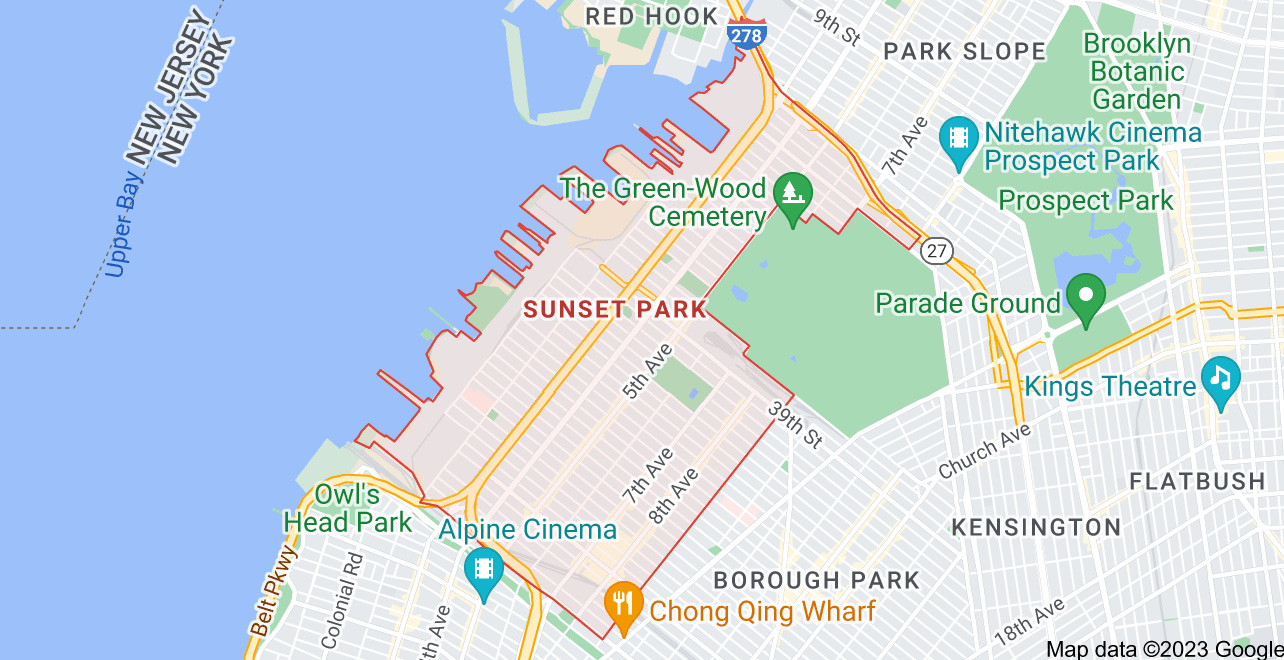
Below is a map from Google with the borders of our neighborhood. Do you agree? Have you ever even thought about it? How much does it matter?
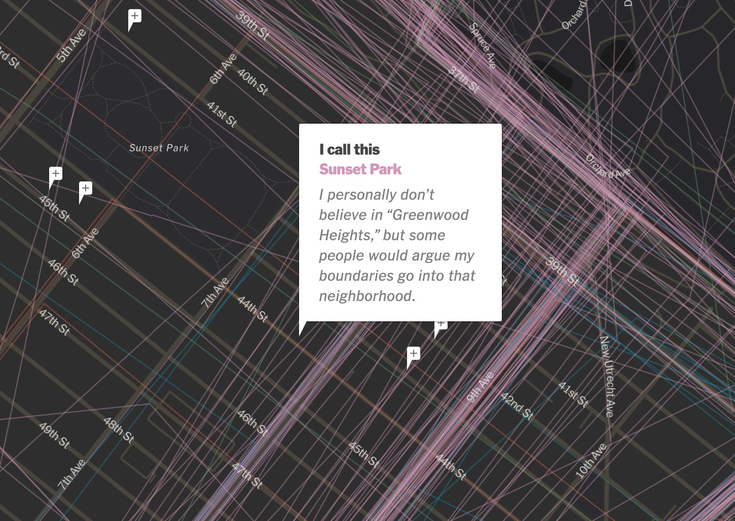
Recently, the New York Times took a look at how these changes come about. It’s fascinating, and there is an interactive component. Here’s a glimpse at the interactive bit questioning the rebranding of the area west of the cemetery as “Greenwood Heights.”
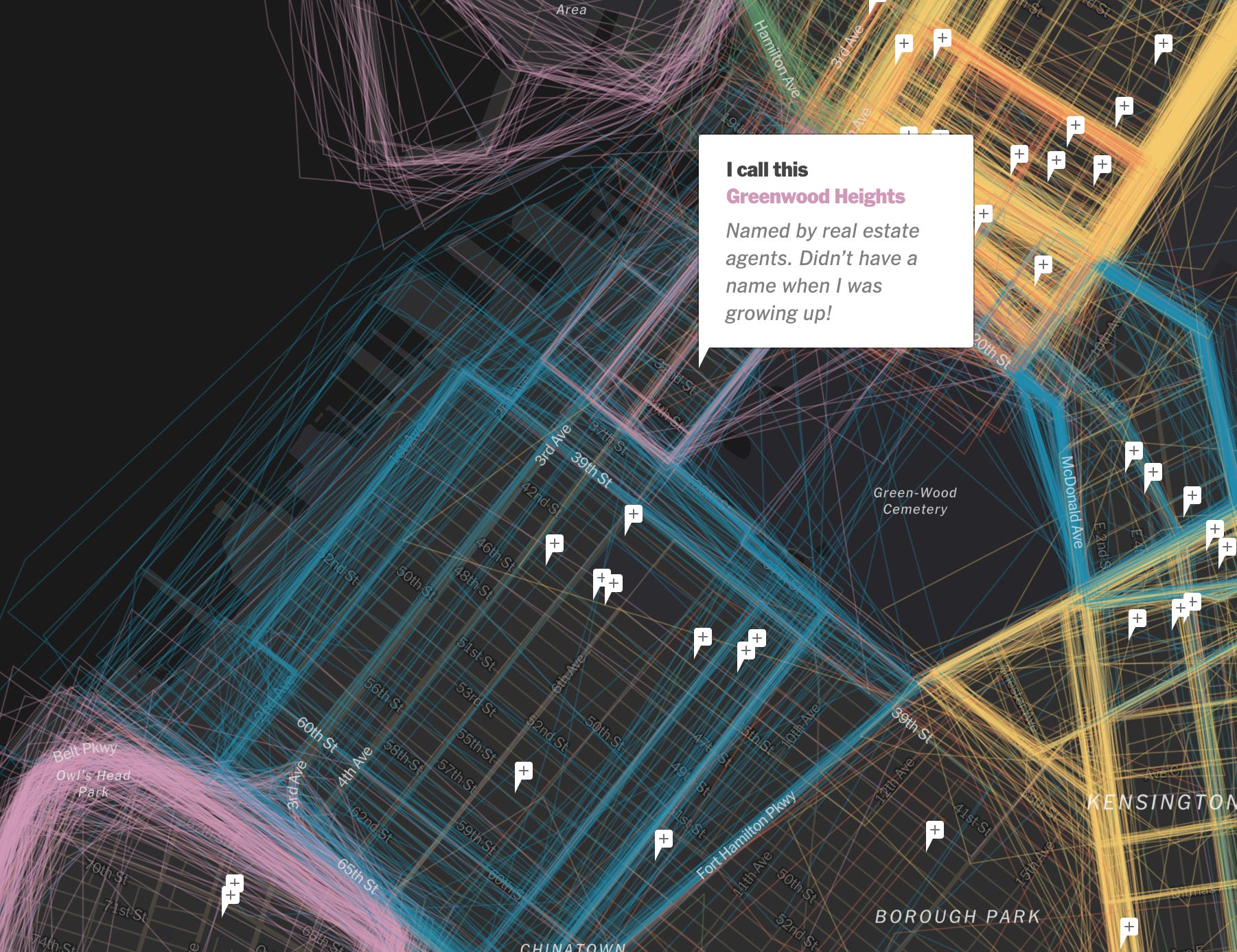
Wherever you draw your lines, it’s an interesting investigation.
An extremely detailed guide to an extremely detailed map of New York City neighborhoods
By THE NEW YORK TIMES: How is a neighborhood born? In a small pocket of the Bronx, the answer involves rising rents, a civil war and an air traffic controller at Kennedy Airport. To see for yourself, zoom in with Google Maps near the Bronx Zoo, past Van Nest, Bronxdale and Morris Park. Get closer, and another label appears: LITTLE YEMEN. This neighborhood exists on the map partly because a Yemeni air traffic controller, Yahay Obeid, named it, by reporting that a place was “missing” from Google Maps, and submitting a suggestion for what it should be called. The name made sense, he thought, as more and more Yemenis were moving there — like those priced out of other neighborhoods or immigrants who had fled Yemen’s civil war. After submitting the name a few times, and working with a reporter on an article about the area, Mr. Obeid checked again. “Boom, within a couple of weeks, it was on the map,” he said. It’s a New York pastime to gripe that neighborhoods are invented and defined by real estate brokers, developers and other city gatekeepers. But the more interesting truth may be that they are also reinvented and reinforced, refracted through race and class, by us: by the air traffic controller who lives in Little Yemen, by the Manhattan community manager who’s sure his constituents live in East Harlem — and not “Upper Carnegie Hill” — and by the Brooklyn residents who decided to name a relatively flat piece of land Boerum Hill. A name has power. It can foreshadow who will be moving in. By itself, it can conjure so much: gentrification, displacement, inequality, status. When we argue over names, or even invent new ones, we may be trying to exert some of that power — or lamenting that others have more power than we do. We asked New Yorkers themselves to map their neighborhoods and to tell us what they call them. The result, while imperfect, is probably the most detailed map of the city’s neighborhoods ever compiled. … READ MORE
PARTICIPATE …. More from The Times: “… readers have sent in more than 7,500 new submissions from across the city. These submissions have brought 36 new neighborhood names to the map (you can see them now!) — places like Starrett City, Beverly Square West, Lefferts Manor, Wingate, the Broadway Triangle, Pigtown and The Hole.”
Play with the INTERACTIVE MAP
thank you for posting this story. It's fascinating!!